The irrigation facilities of Urartians used even today are a successful and systematic architectural product. The buildings that have been resisting against earthquakes in the region for thousands of years show that they have been built by taking very conscious engineering measures.
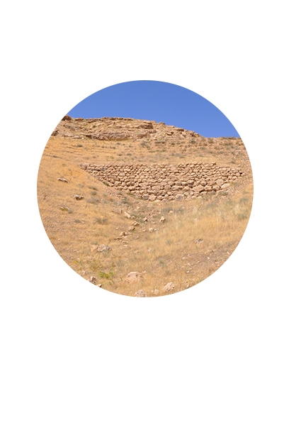
When the Urartian irrigation structures are mentioned, it is certainly the Minua (Şamram) Channel that comes to our minds first. It was built to bring water to the Van Plain, where the capital of the Urartian Kingdom is located, from the Gürpınar Plain, 50 km south of Tuşpa/Van. The Minua Canal, which is still partially used today, meets the water needs of the fields, vineyards and gardens where it passes. More than 5000 hectares of land along the canal can be irrigated and planted with water carried by the Minua Canal.
The inscriptions were constructed to 15 different points of the Minua Channel, Maintaining its existence for approximately 2700 years and giving life to agricultural areas in the region where it passes, almost in the same nature as the contents of which are given below.
“Minua, the son of İşpuini opened this channel thanks to the power of God Haldi. It's called Minua. Thanks to the greatness of God Haldi, Minua, the strong king, the great king, the king of the Biainili countries is the master of the Tuşpa city. Minua says: Whoever deletes this text, who sees this, whoever told to another ‘I opened this channel’; is ruined by God Haldi, God Teiseba, God Şivini and all the gods; shut off from sunlight.”
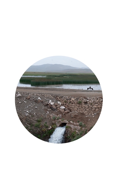
The Keşişgöl dam built by II. Rusa on 20 km east of Van is another important water structure belonging to the Urartians. It was built as a part of the new irrigation system which was formed with the establishment of Toprakkale that II. Rusa, the Urartian king, named it as II. capital. We can learn about this activity in stela of II. Rusa in Berlin. The long inscription text, which cannot be understood for a large part, mentions the purpose of the construction of Keşişgöl:
“I've saved a lot of water here for channels, wheelraces. I called it the Rusa Lake. In the meantime, so far for the barren land I opened a channel to the city of Rusa. The fertile soils were never farmed berfore.
Rusa says that I order Tuşpa public to process the land in front of the Rusahinili… to to clean them with tools after establishing the city of Rusa, after forming this lake.
Rusa says that I orderto be established vineyards and gardens to the prepared land. I did great things there. This lake is the guarantee of the future for Rusahinili…”
Keşişgöl Barajı
Menua Kanalı Destek Duvarı